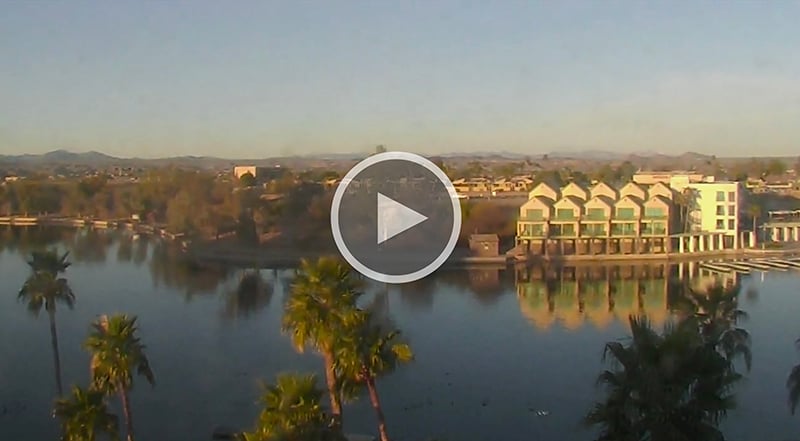
Dead Burro Canyon Trail
Description:
Dead Burro Canyon Trail is a loop hike for the adventurous around a mountain block through a deep scenic canyon in Havasu National Wildlife Refuge, a wilderness setting where very few trails exist. Look for wild burro and Bighorn sheep!
Trailhead Location:
Milepost 192, Highway 95
Vehicle required:
Car
Time to Trailhead
From London Bridge:
20 minutes
Trailhead GPS coordinates:
N 34°36.390’ W 114°21.698’
Directions to trailhead:
Go north on Hwy 95 past the airport. About .3 miles after milepost 192, look for a fairly level, hard rock parking area off-highway on the west (left) side. There is a safe turnaround less than a mile away if traffic is heavy.
Note: From July 1 to December 31, the unpaved road off Hwy 95 at milepost 192 is not chained off. You can drive a 4-wheel-drive vehicle about one mile on the gravel road and park, allowing you to reduce the hike by two miles and 45 minutes.
Trail route instructions:
- Walk south a short distance from the parking area until you reach a dirt road that leads out from milepost 192 on Hwy 95 (elev 930 ft).
- Turn right and follow the dirt road past the hills on the left (about a mile), then head right on another dirt road to the top of the left bank of a wide deep wash.
- Cross the wash on jeep roads (on the right or left) or walk directly across. A very noticeable jeep road exits the wash on the other side.
- Follow that jeep road on the mesa toward the lake. Carefully step over a barbed wire fence erected along the boundaries of the Havasu National Wildlife Refuge, and continue straight ahead as the trail, which momentarily disappears, eventually descends into a small wash on the right.
- Shortly turn right towards Dead Burro Canyon (gap in the mountain) and look for a vague trail up the right bank marked by rock cairns. (You cannot proceed if you attempt to go directly into the gap.) Climb up the right bank to about the height of the waterfall (elev about 720 ft.). Bear left towards the edge of the cliff and carefully walk around the edge of the canyon bank and along a ledge to the top of the waterfall. This may be frightening for an inexperienced hiker. Use caution!
- Continue making your way on the rocks atop the right bank and along the wall until it eventually drops down into the wash. The last ten feet on this descent is not dangerous, but may require scrambling on all hands and feet.
- A burro trail on the other side is an alternate route, but by the time you find an easy way to get to it, it may not be worthwhile.
- Either way, continue up the wash, climbing up several difficult waterfalls, until it widens, and keep going all the way to the rear of the canyon where it splits right and left.
- Take the wash on the right up to a saddle overlooking a valley (elev 1150 ft). Use burro trails when possible. Good lunch spot.
- Make your way down into the valley to the wash below and follow it downstream (to the right). You will eventually cross under a cable leaving the boundaries of the wilderness area.
- Watch for the radio towers atop the mountains in the distance and continue towards them. Just when you lose sight of the towers, the wash opens up and forks. Take the second road on the left and in about a hundred yards, a steep jeep road on the right exits the wash and continues atop the mesa back to the main wash completing the loop.
- Turn left and follow the main wash back to where you parked your vehicle.
* Aesthetic Rating: The more stars, the more desirable the trail the in terms of remoteness, natural features and scenic beauty
Arizona hiking safety
The rugged beauty of the Lake Havasu City area, just down the Colorado River from the Grand Canyon, makes a lasting impression. But the desert can be hazardous. Many trails are unmarked and infrequently traveled. Please consider these suggestions to make the most of your adventure:
- Avoid hiking during the summer, approximately June 15 to September 15, when daytime temperatures can reach 120° or more.
- Do not hike in washes when heavy rainfall is anticipated to avoid the threat of flash floods.
- Always take plenty of water; plan to carry at least one quart of water for every four hours you hike in direct sunlight.
- Wear a hat, sunglasses with UV-protection, and sunscreen.
- Print off a copy of the trail map from this webpage and carry it with you if you the route is unfamiliar.
- Wear sturdy, thick-soled shoes and use a hiking stick if you easily lose your balance.
- Never hike alone and always let a responsible person know where you’re going and when you expect to return.
- Plan to leave on your hike early in the day to avoid the risk of being lost on the trail after dark.
- Travel light; the less you carry the more you will enjoy the hike.
- Leave nothing behind. We want our trails to remain beautiful for your return!